
Draw a location, line or area
Land records
Choose the geometry that represents the actual site and review it before saving.
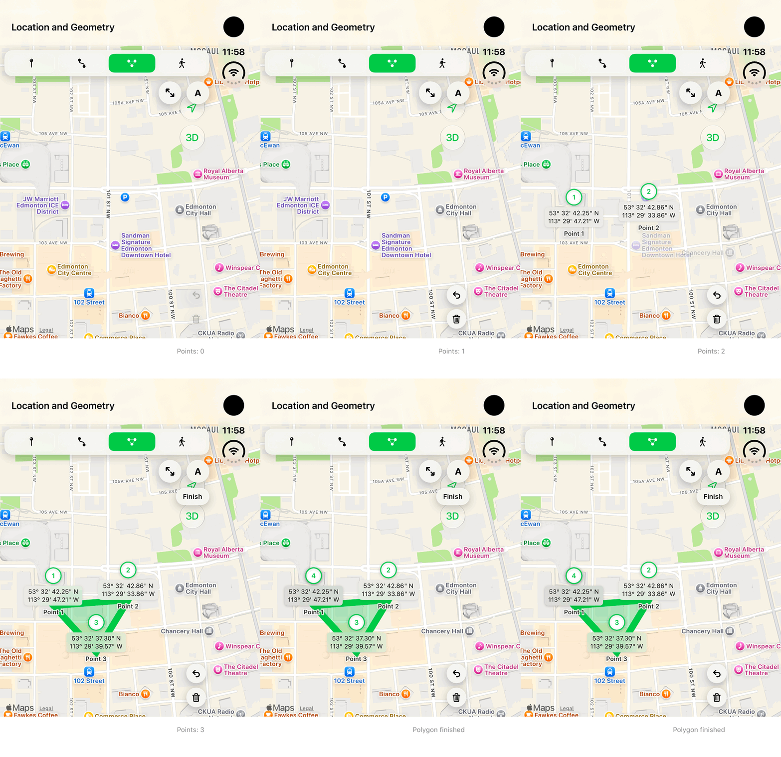
Walkthrough paused.
Follow the written steps or select Play walkthrough to watch the example.
iPhone Duo: add three vertices and finish a fictional local polygon. Finish closes the unsaved geometry; no land record is saved.Open the looping GIF
Follow along
One step at a time.
Choose the geometry that represents the actual site and review it before saving.
Choose the geometry
In Add Land, choose Location, Line or Area.
Set the site
Use the device location only when it represents the field site; otherwise select or enter the intended position.
Add the points
For Line or Area add points in order. Undo removes the last point; Clear starts again.
Finish and review
Finish the geometry, inspect the worksite position, then complete the record.