
Create and maintain an Other Land record
Land records
Other Land provides a flexible named field record with geometry, notes, custom field values and supporting media.
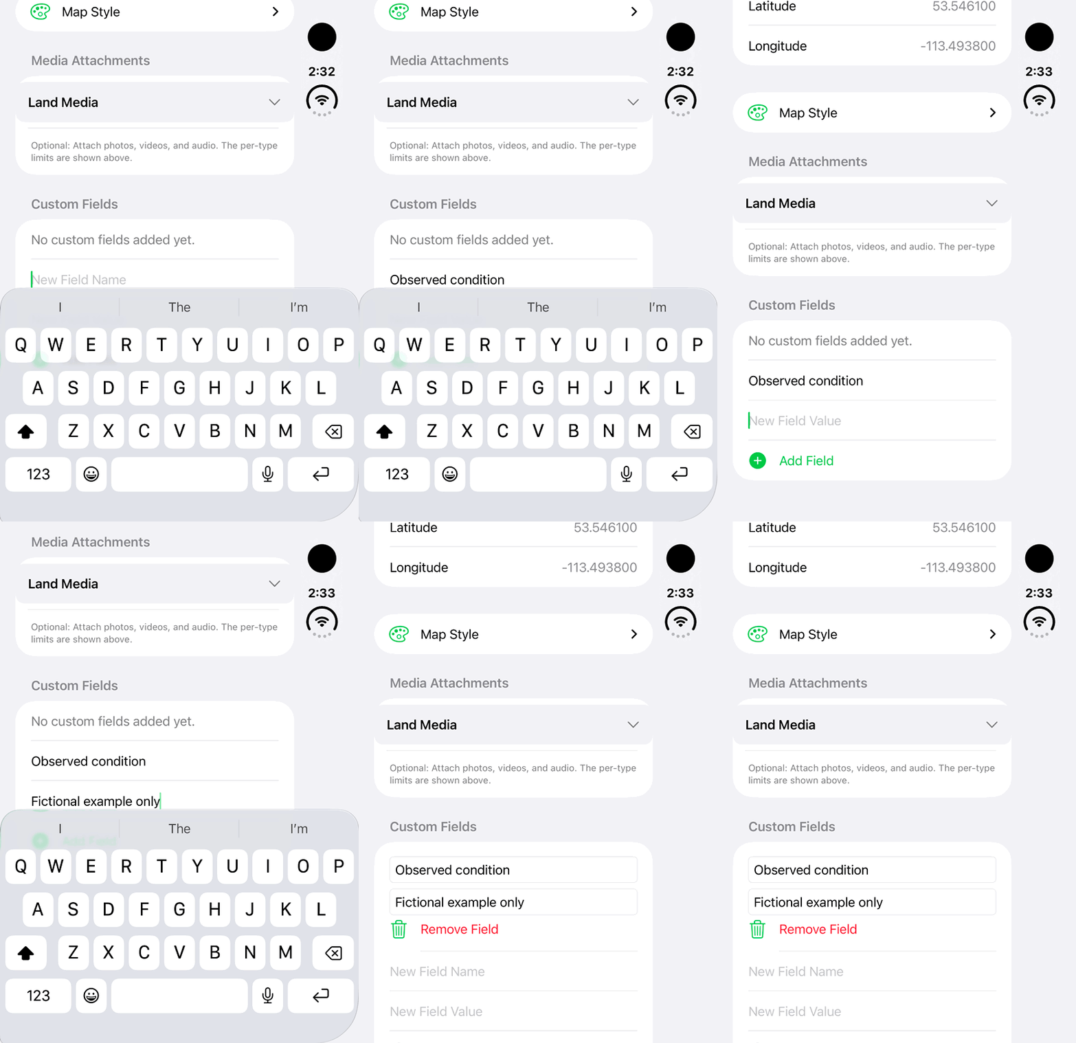
Walkthrough paused.
Follow the written steps or select Play walkthrough to watch the example.
Add a custom field to an Other Land draft: this fictional example records Observed condition. The new row is added in the editor; Save and cloud sync are not shown.Open the looping GIF
Follow along
One step at a time.
Other Land provides a flexible named field record with geometry, notes, custom field values and supporting media.
Choose a flexible record
Open Lands → Add Land → Other Land. Use a clear record purpose, such as an erosion observation.
Name it clearly
In Basic Information, complete Land Name, Category / Type and Notes. Write enough context for someone who did not attend the field visit.
Map the observation
In Map Geometry, choose Location, Line, Area or Track as appropriate. Add and review the points. Undo or Clear when needed, then finish the shape.
Add the details your project needs
In Custom Fields, enter New Field Name and New Field Value, then tap Add Field. Use explicit labels such as Observed condition. Review and edit each field name/value pair.
Attach evidence and save
Use Media Attachments for permitted photos, videos or audio within displayed limits. Review the content and optional Map Style, then Save the record.
Keep it useful over time
Reopen the record and use Edit Information where permitted. Review Share Access before inviting collaborators. Use Export Data and Share when a separate PDF or GIS copy is needed.